
Small disclosure to start: this took more time to write out and get posted than I had wanted, but that’s what happens when you go right from a vacation into playing catch up at work immediately the next day after getting home. Our trip took place from July 15-19, so I’m not super far off getting it posted, just later than I had hoped to.
Ethan and I were walking along one of the trails (above ground) in Mammoth Cave National Park when I looked around and realized we have this habit of going on our vacations to see rocks. Exhibit A, the Smokey Mountains on our trip to Tennessee in 2017. Exhibit B, our trip to Pictured Rocks in 2018. Exhibit C, making a stop at Sleeping Bear Dunes (it counts because sand is just very itty bitty crushed up rock bits) in 2019 while visiting family in the area. And now, several days spent at Mammoth Cave.
Fun fact. Our last actual trip somewhere as a vacation and not involving seeing family as the primary purpose of the trip was way back in July of 2018, when we went up to Pictured Rocks. Needless to say it’s been a minute.
We started by stopping over and dropping Blue off at my sister’s in Ohio as it was on the way down to Mammoth Cave, as Blue is not a huge fan of more than 3 hours in a car, and the fact that the cottage we were staying in had a no pet policy. It is what it is.
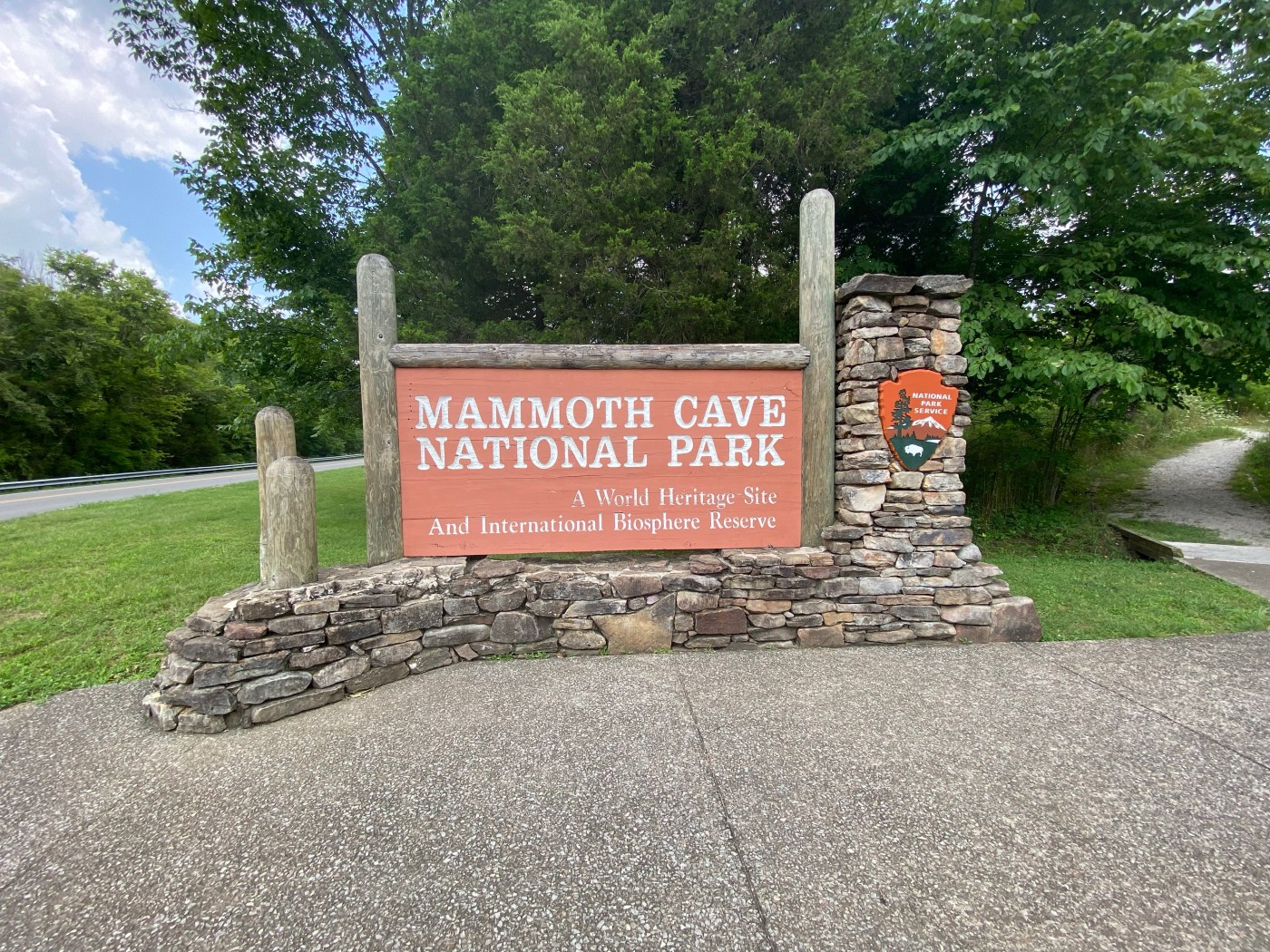
We left Ohio early Thursday morning and drove the nearly five hours down the rest of the way to the park. We made it to Park City just outside the park itself around 12:30/1pm and made our way up to the sign at the entry. I was getting grouchy as I had driven the majority of the way from Ohio after we stopped in Cincinnati for gas and all I wanted to do was get into the park and get out of the car and go walk or hike on a trail in the woods.
Luckily, with a little over two hours until we could check in at the lodge, that’s what we did.
We started at Sloan’s Crossing Pond Trail, the first trail we came upon from the entry we took into the park. It was a nice little half mile or so loop around a pond that I still do not remember the name of (even after looking at it at least twice) other than it has nothing to do with someone named Sloan or a crossing of any sort that I know of. No Sloans to be found, given name or surname, however, there were a good number of giant, fist-plus sized frogs singing the early afternoon away and keeping the bugs at bay in spite of our closeness to the still water and the 90 degree day. The heat wasn’t even troubling to us on the walkway itself thanks to the trees on all sides.
After Sloan’s Crossing, we drove on further into the park, turning away from the road that would take us to the lodge and visitor center to go and find Turnhole Bend Nature Trail. The road leading to it was under various stages of construction – every so many dozen yards they were putting in what I assume was a new runoff system to help with erosion along the side of the road. Because of the construction, we completely drove past the trailhead for Turnhole Bend – largely because the small parking area was seemingly being used to house the construction vehicles when they weren’t in use, so the place was marked off with caution tape. Due to there being no easy place to turn around on the road, we ended up driving entirely out of the park to do so, pulling in to a church lot right outside the border and making our way back to park in the grass along the marked off lot.
Here’s the thing about the lot being marked off. There was no indication that the trail itself was closed – no signs or postings on the map at the trailhead. So we went for it, and quickly discovered there was no way anyone had been on the trail in at least a week. How we discovered this? By walking into threads of spider web over and over and over the entire way around. Not the most pleasant of ways to go on our second venture of the trip. Luckily, it has some really good views at the outlooks and was only about half a mile around the entire loop, so the bugs and webs were more or less bearable.
After leaving Turnhole Bend, we drove down to Cedar Sinkhole Trail. Now, on the trails app I have on my phone, this was advertised as about 1.5 miles. On the sign at the trailhead, it was allegedly 1 mile out and back. By the time we were done with it, it had to have been at least 2 miles (Ethan thinks this is due to some of the backtracking we did trying to figure out which way the loop went. I disagree).
Mixed and inaccurate distances aside, this one was really cool. The trail took us out to a set of stairs that descend most of the way into the sinkhole, with sturdy paths and overlooks and fun informational signs describing how the water runs down into the sinkhole from rain and goes into the underground river that once made Mammoth Cave and still exists on the lower levels of the cave system. Because of the heat and lack of recent rain, the slopes that water would typically travel down to the sinkhole were fairly dry, though much of the path we were on, a good ways up from the sinkhole itself, were damp and relatively muddy. Coming back up on the other side from where we had come down was an overhang in the rock that another overlook brought us out and under, the rock curving around the topmost level of where the sinkhole had, once upon a time, begun.

Turnhole Bend 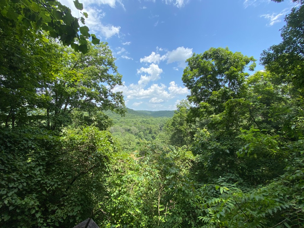
Turnhole Bend overlook 
Cedar Sink lower level overlook 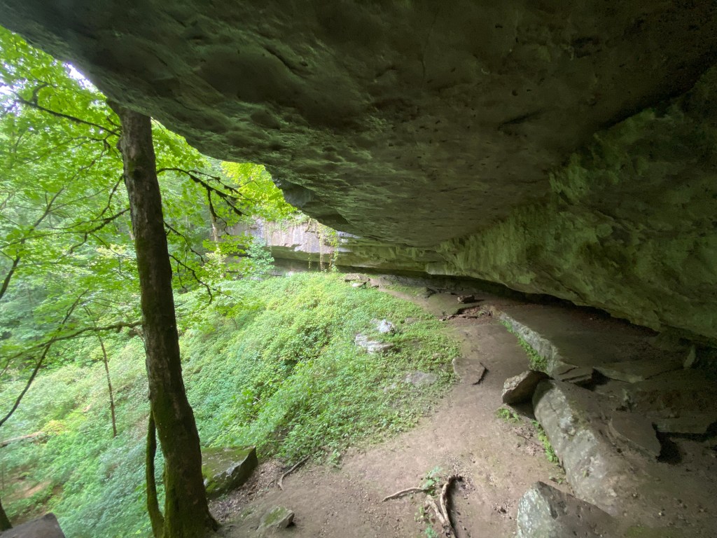
Cedar Sink upper level overlook
By the time we made it back to the car, it was close to when we could check in at the lodge so we made our way up to the central part of the park where all the touristy bits and lodging were located. As soon as we had gotten the key and settled all our things into the cottage, we set back out to wander through the lodge, check out the visitor center, and head off on the Dixon Cave and Styx Springs loop.
Like the Cedar Sinkhole, this one was not super well marked for distance and I am fairly certain we were again about 2 miles rather than the app-advertised 1.8, but! Dixon Cave Trail had us start going past the Historic Entrance to Mammoth Cave, where guided groups were coming up or going down and rangers were posted to make sure everyone was doing what they were supposed to/not doing anything they were not supposed to. As we passed by, we were hit with the most wonderful cool gust of air coming from out of the cave. Mind you, it was still about 88-90 degrees Fahrenheit at this point, and the air in the cave is on average a nice 54-56 degrees. It was amazing.
We only stopped for a moment or two to read the sign right past the entry indicating what was in which direction before climbing up the incline leading toward Dixon Cave, where we arrived a few minutes later and read about how Dixon Cave is where the bats come to hibernate during the winter, in addition to Dixon Cave once upon a time being a part of Mammoth Cave. Some time in the past, either hundreds of thousands or even millions of years ago, there was a sink hole that became what is now the Historic Entrance to Mammoth Cave that collapsed the section of cave that connected Dixon to the rest of the cave system, making them now two separate entities.
Continuing up from Dixon Cave, we reached some of the bluffs overlooking the Green River below, though thanks to the dense foresting on the slopes its rather difficult to see much of anything aside from trees and green at this time of the year. We made our way down the bluff and back to the trail that would bring us up a steady (steadily painful) incline back past the Historic Entrance, where we again stopped to catch our breaths and try cooling down with the natural air conditioning coming out of the cave itself.

Dixon Cave overlook 
Overlook from the bluffs 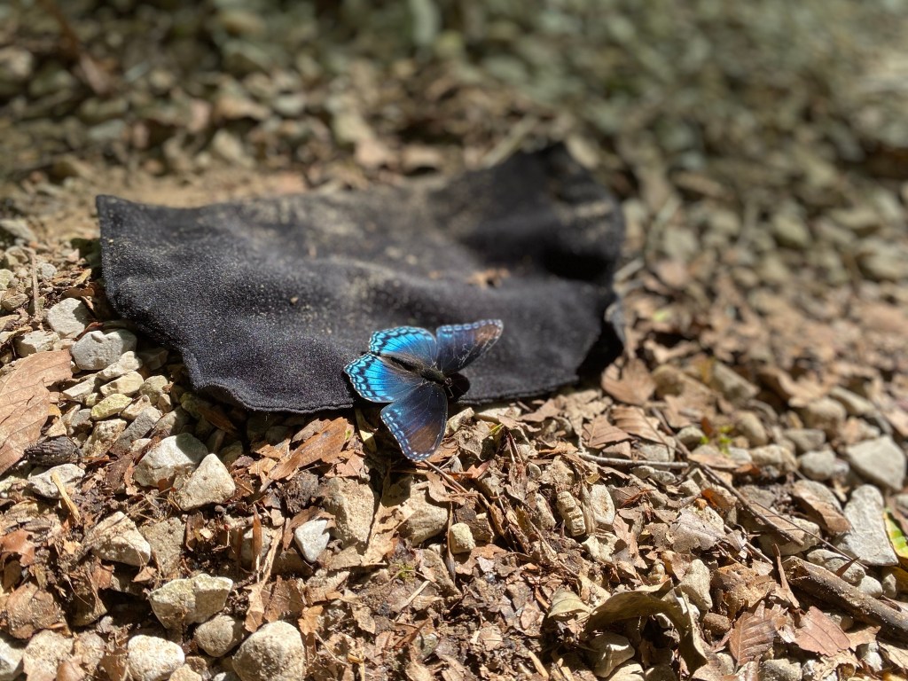
One of many butterflies to give me jump-scare on the first day of hiking – they were EVERYWHERE
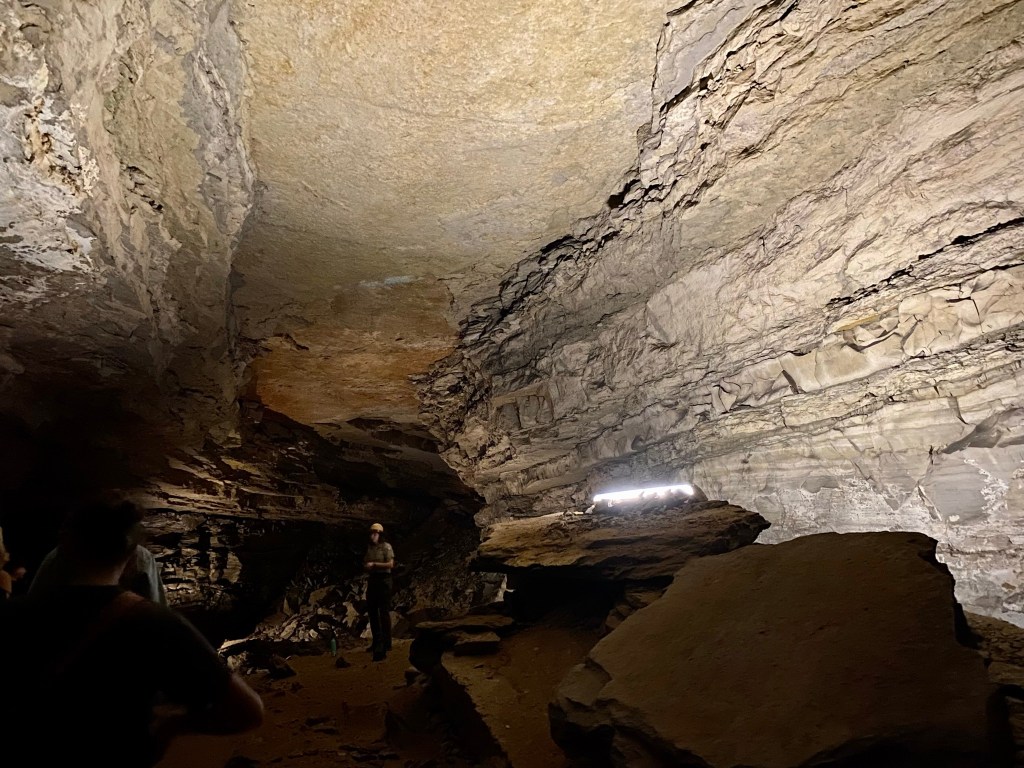
Friday morning, we set off for one of the cave tours. I had booked us a total of two cave tours for our trip back around mid-June when they first became available online. Up until the point that I had booked them, only the Self Discovery Tour was actually available due to COVID restrictions and limitations. With things really opening back up mid-June, they started to offer more tours once again, though at lower participant numbers which worked just fine for us.
I managed to get us the Cleaveland Avenue Cave Tour, which was only being run once a day at the time. This one required us to hop on a bus and ride out about 10 minutes to the Carmichael Entrance, a man-made entrance that we learned was put in during 1931. One of the cool things about this tour, aside from seeing the interior of some of the cave and learning a fraction of its history, was that both our lead and trailing ranger on this tour were women. Obviously women are very often just as involved in the ranger industry as men, but it was just something I noted as neat considering I had mostly only seen guy rangers around the parts of the park we had been to up to that point.
On our way through the cave from the Carmichael Entrance to the section named Cleaveland Avenue about a mile in, we learned some of the geological history about the cave, such as how the river used to run through and carved out the canyons and tubes over thousands and thousands of years. We were told how, due to layers of shale and sandstone sitting on top of the limestone that made up much of the cave itself, Mammoth Cave is fairly well protected by a roof of sorts, enabling a significant amount of the system to be dry. Moreover, in the thousands of years it was forming, the ceiling had taken an arch shape, the most stable shape in nature, making the cave system an overall very stable environment.
As we went along, we stopped to look at these small, sparkling formations on the walls and ceilings that our leading ranger informed us was gypsum. A lot of them had taken the shape of flowers, and we learned later on that in the early years of Mammoth Cave tours during the 1800’s, tourists would take the gypsum flowers to bring home as souvenirs. However, because it is a very fragile material, as soon as any moisture came into contact with the gypsum it dissolved away.
The gypsum flowers themselves, smaller than the cup of a cupped hand, were thousands of years old. It took hundreds of years for each of them to grow the width of your pinkie finger nail. There was a space along the path where a failed attempt in the mid-1900s to bring electricity down to the cave had left an inch or so wide hole in the ceiling, enabling water to leak in and drip down on to the floor. The few feet around it was entirely devoid of the gypsum flowers, as over time the dampness melted them away to nothing.
Canyon just inside the Carmichael entrance 
Inside the cave 
Inside the cave 
Closer look at some of the gypsum formations on the ceiling and walls
As we got to the turn around point, we heard the first mention of Stephan Bishop, who in the mid-1800s was an enslaved person serving as a tour guide in Mammoth Cave. Bishop was credited with doubling the known areas of the cave at the time (from around 8 miles to nearly 20) and was often requested by the wealthy tourists who came to the cave.
Along the return trip from Cleaveland Avenue, the leading ranger went over some of the human history in the cave – including scratched names on the walls, candle-soot etched names on the ceiling, and how in the early days the tour guides were typically unpaid enslaved individuals who only made money from any tips they received on their tours.
We also paused to talk about the CCC, established in the 1930s to help make jobs during the Great Depression. A lot of young men aged 18-25 were hired to come out and help make Mammoth Cave into a National Park, doing work both above and below ground on things like trails and housing. When 1941 rolled around, these young men dropped their tools and went overseas to fight in WWII, and only some of them ever came back home.
Right before we went back up the two-hundred stairs to the surface through the Carmichael entrance, we stopped to look at a few of the historic signatures in pencil on the wall. One was of a young man who had worked for the CCC, and he had boxed his name in with a date of either 1936 or 1939. He was one of those who had gone off to war when the time came, and the rangers and historians know a little about him because he later came back to the cave and added “Dr.” on the lines of the box in front of his name. He’s gone to war, come back home, and completed his degrees before once more taking a trip to Mammoth Cave as a visitor instead of a worker.
After lunch, we set back out on some of the trails near the lodge. We were thirty or forty minutes into it, if that, when we started to hear booming sounds in the distance around the Mammoth Dome sink (on our next tour in the Mammoth Cave we came back up through Mammoth Dome below the surface).
There was a decent amount of construction going on in the park while we were there, including work along the sides of the roads in various locations as well as some walkway work up and around the lodge. Based on our location, my guess was that maybe there was some work going on up ahead near the river, as the road that was semi-nearby where we were hiking was closed during the week. We made it as far as Whites Cave, a small little opening above the ground (that had been barred off to prevent trespassing and vandalism), when the booming started to sound more and more like thunder.
Looking skyward, it was still bright, sunny blue skies. Nevertheless, we turned to begin heading back to the split by Mammoth Dome sink that we had passed about ten minutes prior to cut down another trail that would, hopefully, bring us back up toward the lodge faster than if we simply returned back the way we had come down. As we started down this other trail, a big gust of cool air came from behind us, and looking up we began to see darker clouds gathering.
Now, when we had first set out, we stopped at the lodge to check the weather. It had allegedly been clear for the afternoon aside for a chance of rain, but no thunder/storms were necessarily expected. In any case, pop up storms do happen from time to time, and we had been out in one on our trip to Tennessee several years before, an experience I wasn’t super keen on repeating.
We came down to the next split in the trail that would really start bringing us back up to the lodge, passing another group that seemed extremely unbothered by the potentially brewing weather, and coming at last to the looping series of broad, switch-back steps that would take us up to Sunset Point and ultimately the lodge. Personally, I do not recommend doing these switchbacks all in a rush the way we did. It is doable, and not intensely steep thanks to the switchbacks, but elevation is elevation and it wore us out. We stopped for a minute at the top to catch our breath, looking out over blue skies with gathering clouds to the south moving somewhat in our direction.
Heading out along Sinkhole trail 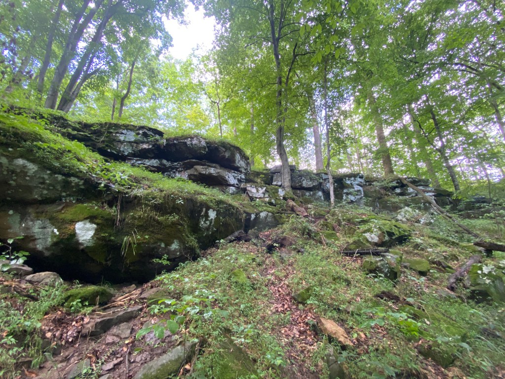
Outcroppings along Sinkhole trail 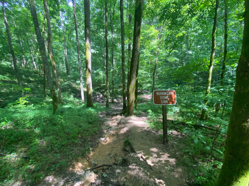
Mammoth Dome sink 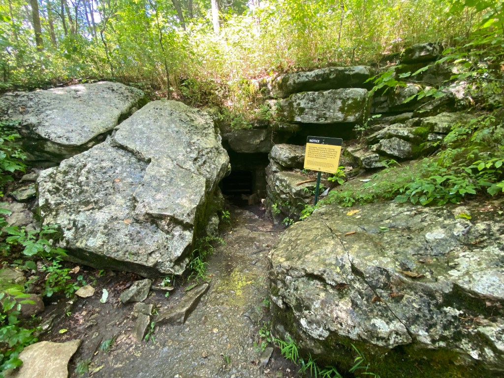
Whites Cave 
All clear skies from Sunset Point
I was a little disappointed by the time we made it back to the lot near the lodge, where there was finally a decent gap in the trees, to see that the storm did exist – but it was far enough south that it would not have impacted us at all had we continued to do the hike we had initially planned for the afternoon. However, without cell service away from the lodge, there was no way for us to be able to check while out on the trail to know that for sure, and we still had a few days left to go out and do the rest of the nearby trails.
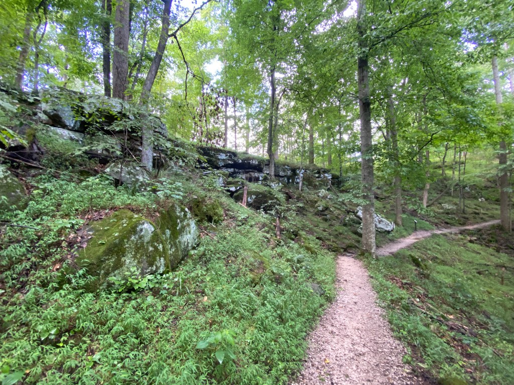
Saturday morning, after resting and recovering from our adventures the day before, we woke early and set out to explore some of the other trails near the lodge. We set off toward the amphitheater behind where the cottages we stayed in were located to go to the campground trail, at the start of which we immediately came upon a doe who was casually grazing and completely unbothered by our presence as we passed her. Honestly the closest I have ever come to a deer in my life.
Making our way around the outskirts of the campground, we jumped on to Whites Cave trail, which we took past where we would have been the afternoon before when we turned around and continued down to Echo River Springs trail. As we went along, we encountered another three deer while on Whites Cave trail: a doe grazing about twice as distant as the first had been, though in the trees off the side of the trail, and a buck and doe on the hillside as we made our way downward. The buck was really neat as he was resting on top of a rock outcropping, tracking us as we went past, while the doe accompanying him was quietly minding her business grazing behind him.
When we got to Echo Springs trail, it brought us on to a paved pathway looping around the spring and its stream. That early in the morning, no one else had been out there just yet, so it was nice and peaceful as we took our time reading the informational signs along the path as we made our way toward the river.
Surprising us both, when we got to the river, the ferry was in operation. When I had initially planned hikes for the trip, there had been several potential candidates for trails across the river that we could do. However, after looking at the map we quickly realized there was no way to get to them without a decent amount of driving out and around the park without taking the ferry. We had no idea though that the ferry would be operational on the weekend until we walked up to the overlook and saw it ourselves, as it had been closed during the week (likely due to construction). Having already decided this was the hike we were doing for the day, we shrugged and shelved the other trails for another trip in the future.
We continued along the riverside for a ways further before the trail split at River Valley Trail, which we had come down the day before from the Mammoth Dome sink. From here, we backtracked the way we had first come down the day before to the Heritage Trail and the lodge.
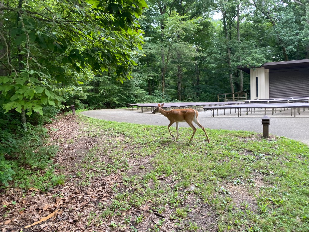
Doe #1 by the amphitheater 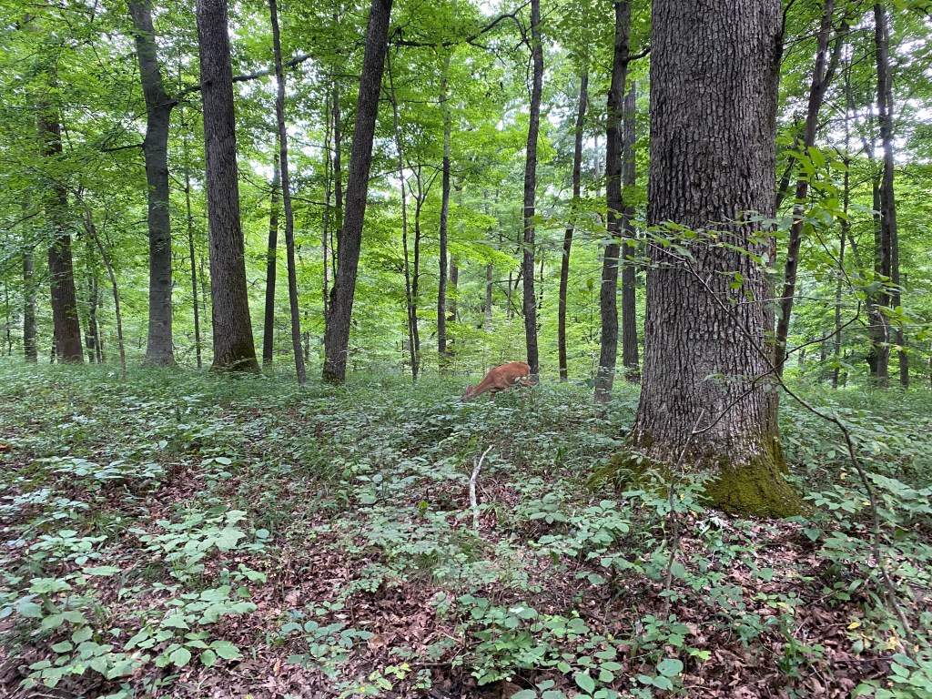
Doe #2 along the trail 
Buck resting on the rock 
Echo River Springs 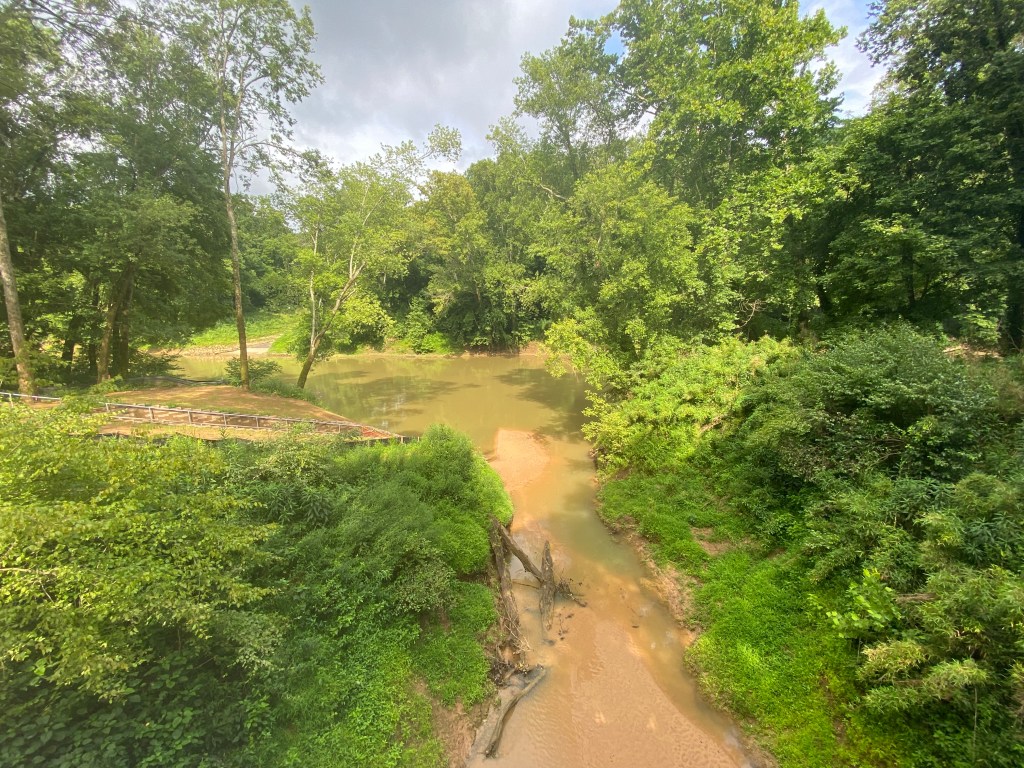
Echo River meeting the Green River 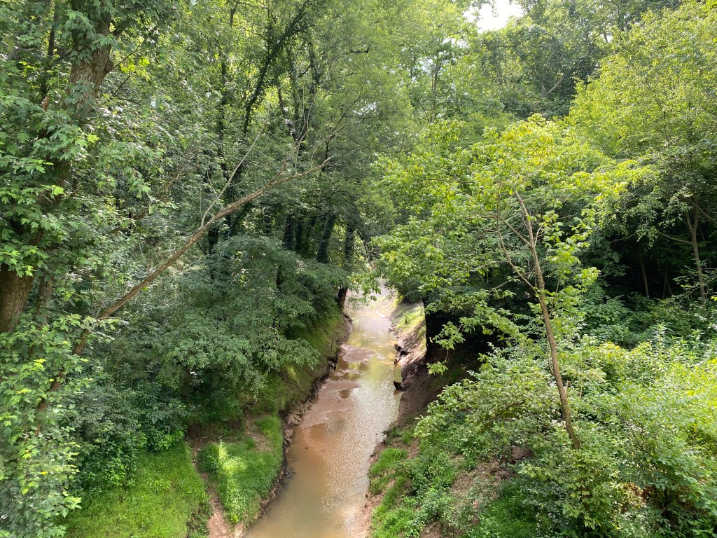
Look back at Echo River
Not entirely sure what to do for the rest of the day after changing our initial hiking plans, we hopped into the car and drove down the main parkway toward Park City to check out Diamond Cavern, a separate cave from Mammoth Cave that sits adjacent to the National Park.
They offer a brief, forty-ish minute tour through the cave, the entry of which is inside their gift shop/visitor center. Unlike the majority of Mammoth Cave, Diamond Cavern was filled with calcite and limestone formations due to not having the same shale and sandstone roof that helps keep moisture out. Needless to say, we got quite a few “cave kisses” from the dripping stalactites. It was really neat to see the many formations one normally associates with cave systems, though the general shortness of the tour is not necessarily one that needs repeating.
One of the neat things we did learn a bit about while on the tour was about the cave wars of the mid 1900s, during which tourist spots including and similar to Diamond Cavern had vandalism wars with one another, in which they would go in to each other’s caves and break off pieces of the formations, write on the walls and ceilings, and all around just be destructive.
During the time of the cave wars, there were weddings hosted in a corner of Diamond Cavern, named the chapel, a space of which the walls were entirely smooth and dry and white from the hundreds if not thousands of eroding hands leaving behind damaging oils on the rock.
That was the repeated mantra on every cave tour we took, by the way. Please do not touch the rocks. Don’t touch them. Human hands carry a bunch of oils that, over time, wear down the natural rock and prevent natural formations from growing.
Overall, it was a fairly informative tour on some of the history of the caves in the area outside of Mammoth Cave, though unlike the other things we did on this trip it isn’t one I personally feel the need to do on another trip there.

Cave vandalism – lots of writing and white stone where hands have worn the natural rock down 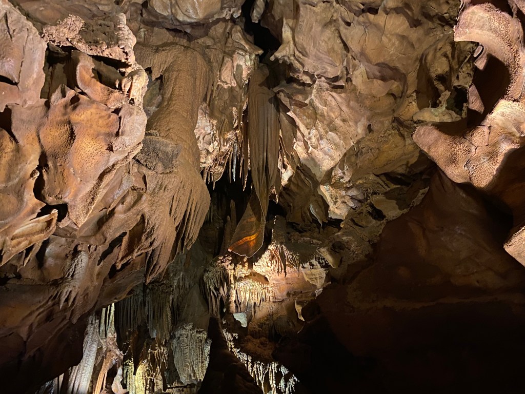
Some of the many formations in Diamond Cavern 
A few additional formations in Diamond Cavern
Having finished the day early, we made an additional stop on our way back from Cave City with dinner at a small pull off trail to Sand Cave. Sand Cave is famous for one specific instance – I cannot remember the name of the man or the precise year, as I lacked the foresight to take pictures of the informational posts along the trail to it.
The one-time owners of the cave were seeking to find more passages ways in Sand Cave to attract more tourists. One of them went in alone one afternoon, and the passage collapsed on his leg, trapping him. They went out to look for him the next day and spent a good number of days trying to free him. During this time, thousands of people came to see and to watch and to try to help. After several days of trying to free him, the passage collapsed further, cutting him off from the rescue party. Another week or so had passed by the time they were able to dig him free once more, but at that point he had already died.
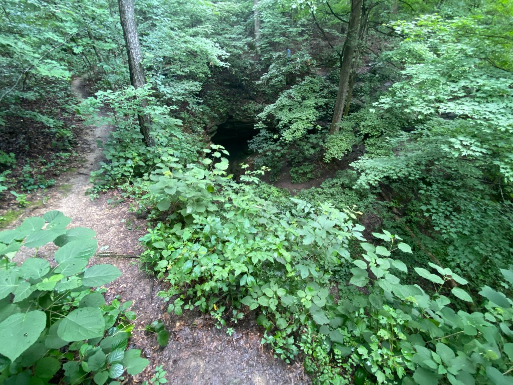
Sand Cave entrance. Note: the dirt track here is not the trail. The trail here was a boardwalk with railings intended to keep people on the marked trail
Morbidness aside, I was really enjoying looking down at the cave entrance until we heard voices from beyond the cave, off the marked trail. It was a man with his two younger children.
Here is the thing. I get wanting to have an adventure. I get wanting to do something fun and going off trail always sounds exciting. However, when you are in a National Park, that is a huge, big no-no. No. Do not do it. Do not go wandering off because it looks like other people did due to there being a lightly worn dirt track in that direction. The trail is marked for a reason, and I will get back to this more with our final hike we went on shortly.
Sunday morning was our final tour in Mammoth Cave: the Extended Historic Tour. While I was excited for the Cleaveland Avenue tour we went on first, I was very much bouncing in place as we waited with our tour group to head down into the Historic entrance.
Now, this tour was more than we had expected after going on the Cleaveland Avenue tour. We had expected based on looking at the cave map that we would go out to one point and turn around to come back to where we started. But, oh, that was not at all what we did.
Starting in the Rotunda, we made our way down Broadway and Gothic Avenue, two of the named passageways in this part of the cave system. This brought us to Giant’s Coffin, an enormous chunk of rock from the wall or ceiling that had fallen long, long ago.
Along the way, we learned about some of the recent and distant history of the cave, including how as early as 10,000 years ago people were coming into the caves and gathering gypsum from the walls and ceilings, leaving behind things like their tools and one or two bodies that had been mummified due to the consistent temperature and environment. In the nearer past, during the early 1800s, the cave had been used for a saltpeter mining operation leading up to the war of 1812 to make gun powder.
Continuing on from Giant’s Coffin, we came to the old tuberculosis huts – or their remains. We encountered two of them, stone structures missing their roofs and parts of walls due to the length of time they had been standing. During the mid-1800s, tuberculosis patients were brought down into the cave as it was believed that perhaps it may elongate their survival from the disease, which, at the time, was deadly. However, in spite of briefly elongating a few of the patients’ lives, it left them almost alien due to the lack of proper nutrition as well as no sunlight. At the end of it all, because there was no tried and true medical treatment for tuberculosis at the time, everyone who came down into the cave with the illness would succumb to it.
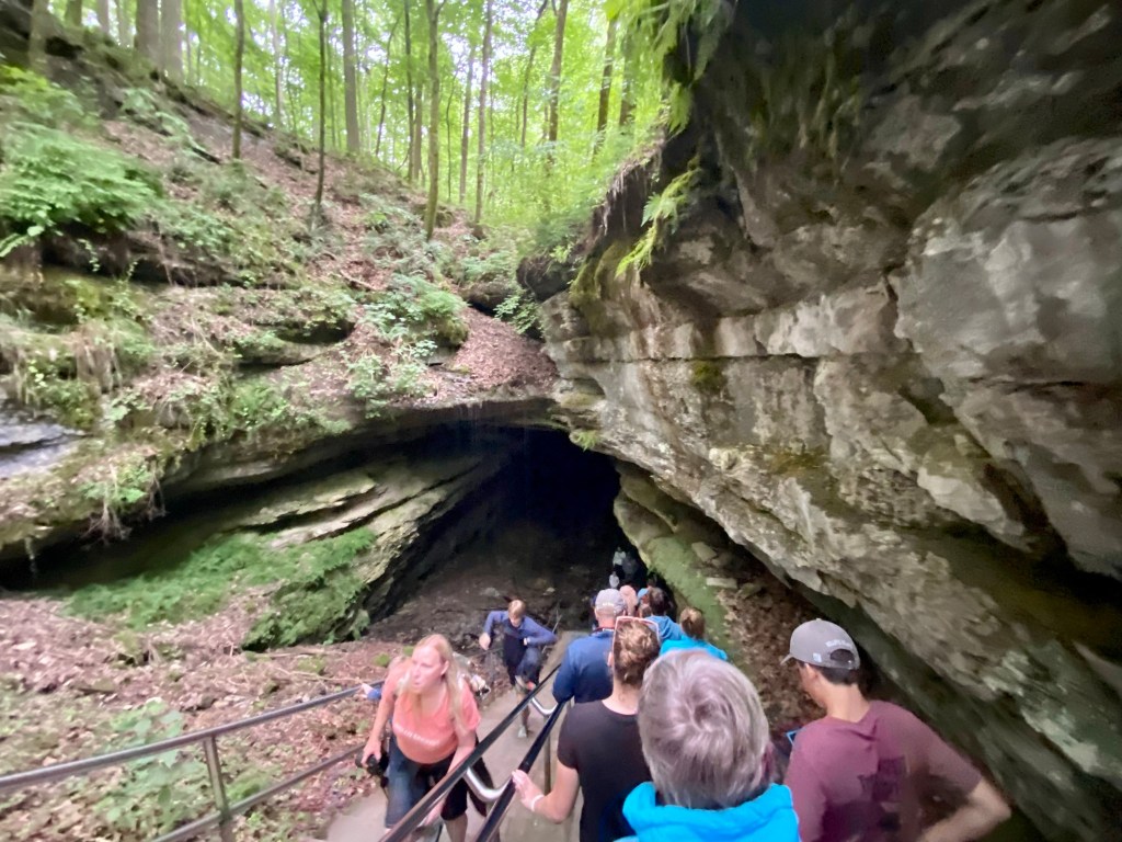
Historic Entrance 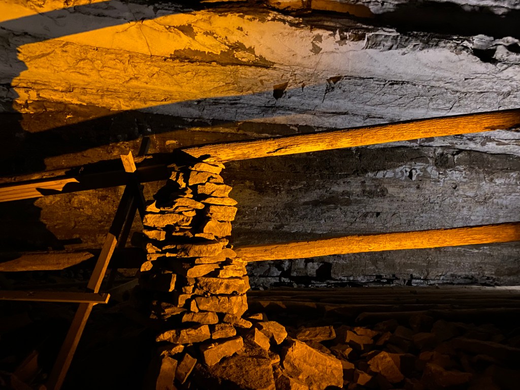
Remnants of the saltpeter mining operation 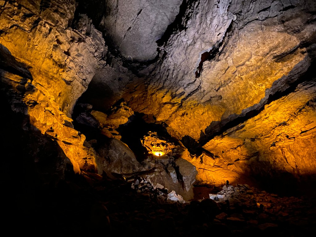
View of one of the side passages in Mammoth Cave 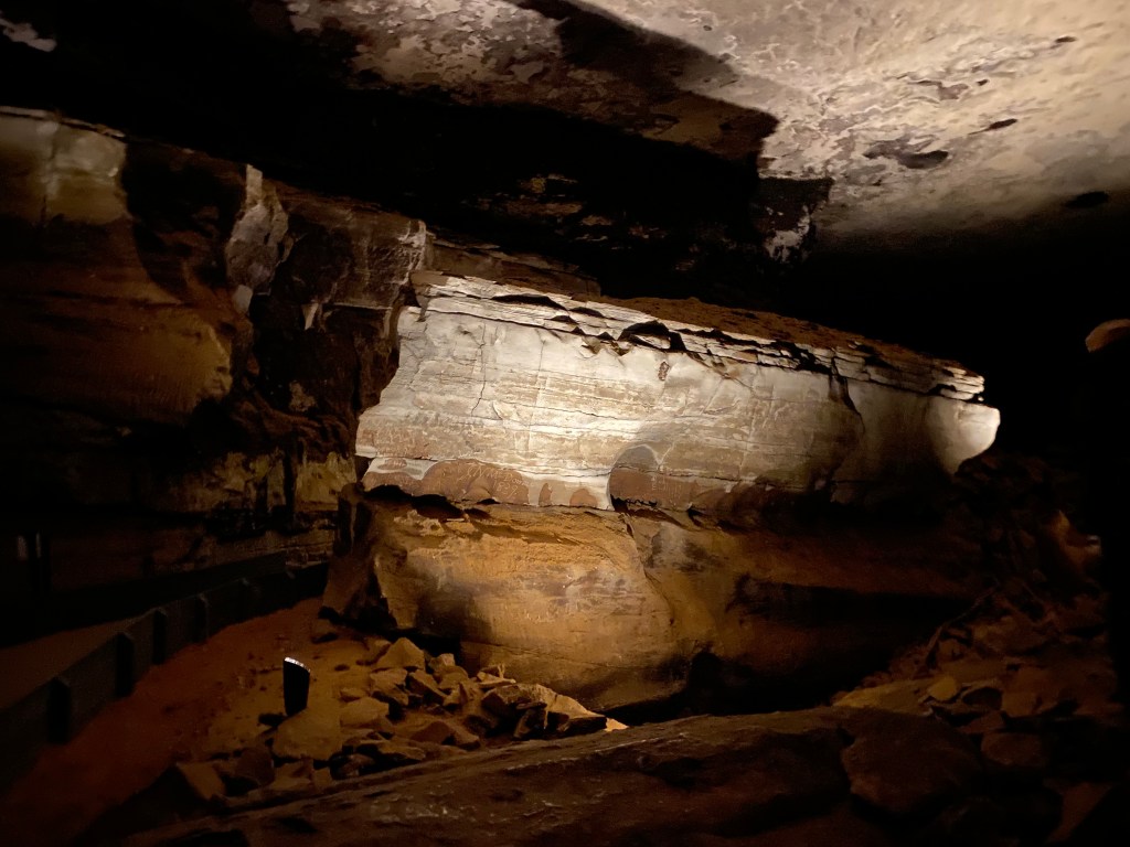
Giant’s Coffin 
One of the tuberculosis huts
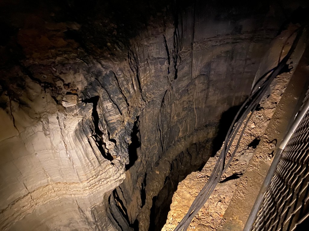
Making our way back to Giant’s Coffin, we cut behind the rock this time to make our way down into some of the twisting passages along the tour. We crossed Sidesaddle Pit, followed shortly after by the Bottomless Pit (not truly bottomless, just named so due to early explorer’s inability to see the bottom). After these two pits, we entered a space known as Fat Man’s Misery. From floor to around waist-height, the space was very narrow, requiring us to walk sideways through the passage. Luckily, everything above waist height was wider. This was the only place we were told it was okay to be touching the rocks, as it was practically impossible not to with the stone rubbing against limbs and sides as we moved.
Immediately after Fat Man’s Misery, we entered a short stretch called Tall Man’s Misery, which required us to bend almost double to pass through, before making it out into the Room of Relief. Slowly, as a number of the tour group was still coming through the last two parts of the passage, we made our way down to a junction with River Hall, where we took a seat on some benches and waited for every one to catch back up. Once we were all together again, We were told there were no more downward stairs – it was time to make the way back up.
After some minutes, we reached Mammoth Dome (the place below Mammoth Dome Sink on the surface!) and got to see some of the few limestone formations in the cave system, due to the small waterfall in the Dome. Here, we waited a few more minutes for the group to gather before starting up the tower and making our way back to the Rotunda before returning to the surface.
Sidesaddle Pit 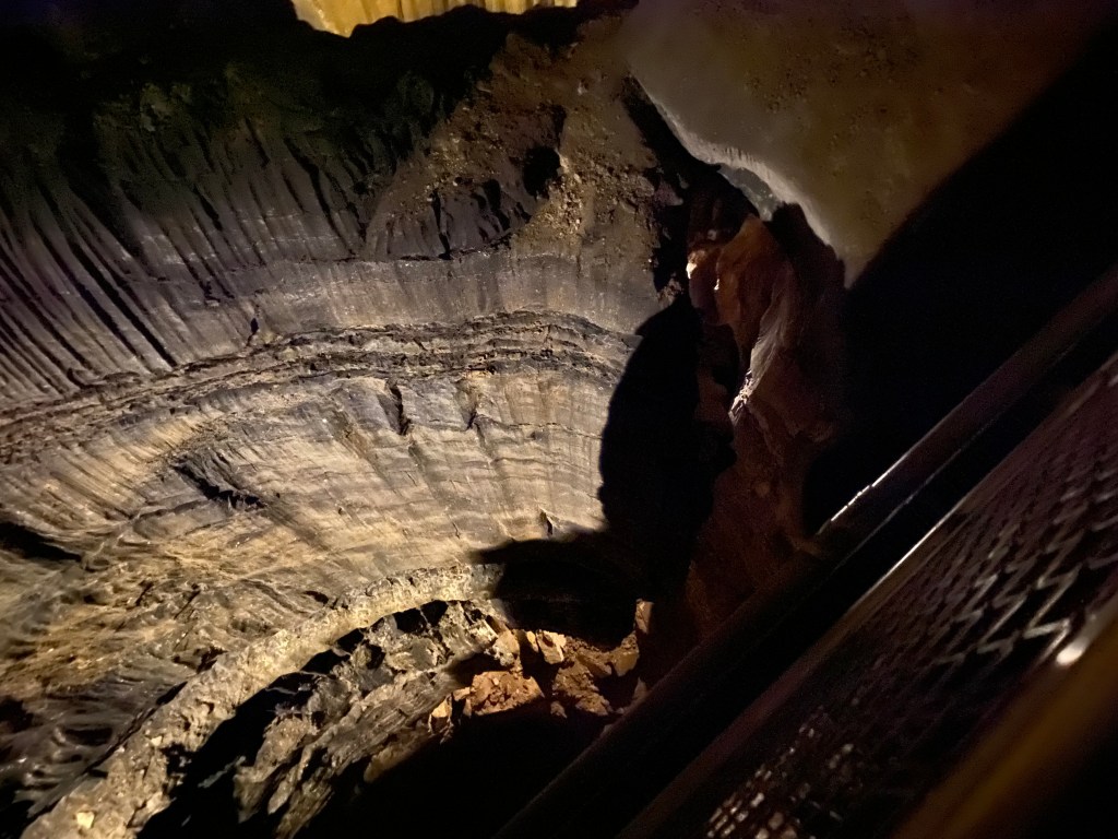
Bottomless Pit 
Just before entering Fat Man’s Misery 
Some of the historic signatures on the ceiling of the passage 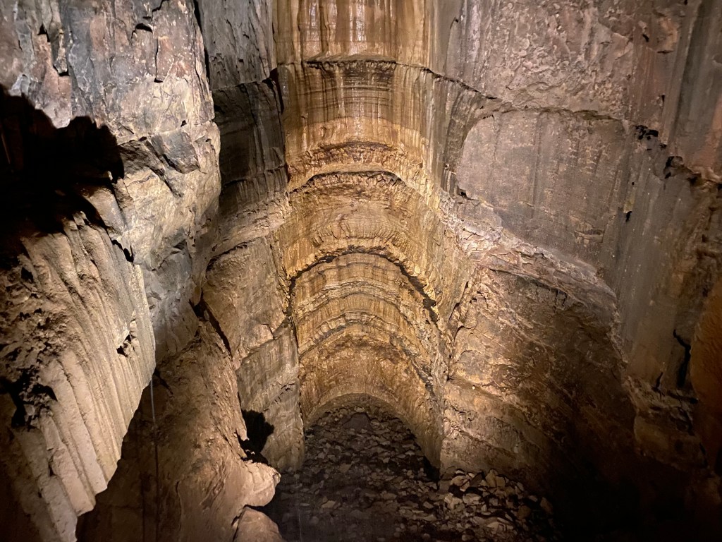
Looking down in Mammoth Dome below the waterfall 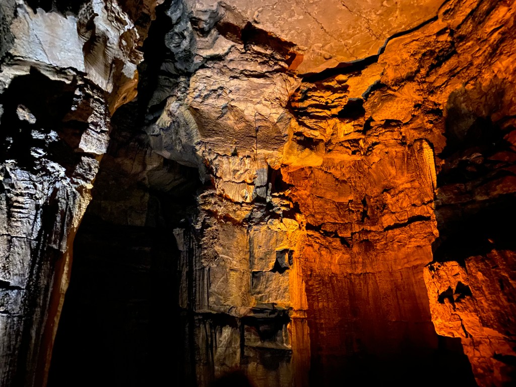
Looking up at Mammoth Dome
After returning from our tour, we had one more hike to go out on. We started this one going down the switchbacks that we had taken up to Sunset Point two days before to venture down to the Styx Springs Overlook.
Here is where the second instance of witnessing off-trailers occurred. Four probably college aged kids were down by the spring itself, having willingly walked past the sign at the end of the walkway instructing everyone to stay on the marked trail due to conservation efforts.
It was one thing back at Sand Cave when we saw the small group going off the marked trail where there was not any signs saying to stay. on. the. marked. trail. I do not think it should be necessary to have to mark every single trail for that to be something people do. But seeing this group go down, when there was a clear, large-worded sign saying not to go off the marked trail made me furious. We had to leave and come back after they had gone because they were being disruptive and making it impossible for other visitors like myself to get a clear picture of the spring.
We went down to the Green River where the Styx Spring met it for several minutes before we returned to the spring itself so I could get a clear, uninterrupted picture. When we finally left the spring, we wound our way up toward the Green River Bluff trail, which we had come down part of several days before after leaving Dixon Cave.
The Bluff trail wrapped us around above the river for a decent length before cutting us back up and away toward the lodge and visitor center, bringing our final trek to a close.

At the base of the steps/switchback up to Sunset Point 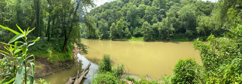
Where the Styx Spring empties into the Green River 
Styx Spring 
Overlook of the Green River from the Bluffs trail
Having tracked our hikes and tours from each of the days on our trip, I was able to calculate that we walked around 30 miles over the four days we were at the park. A significant amount for us, considering we tend to only get out for a hike some weekends and its usually under four miles total throughout the whole day. We’ve already decided we will go back someday, likely not for at least several years since there are more parks we would like to see, to go on more of the cave tours and try to get across the Green River to see more of the trails on the other side.

Leave a comment